
Indoor Navigation Solution: Technologies, Build Approaches, and Real Deployment Costs
Oct 5, 2026
16 MIN READ
An indoor navigation solution is a system that guides people through a building the way GPS guides them through a city, built from three layers: an indoor positioning layer, a routing engine, and a mobile or web interface. GPS signals fail indoors, where people spend roughly 87% of their time, according to Lawrence Berkeley National Laboratory data cited by Zappar. So these systems locate users with Bluetooth, WiFi, ultra-wideband, or the phone camera instead. A pilot floor can start near $20,000 in a few weeks; a full-campus rollout runs $150,000 to $300,000 or more over 6 to 12 months.
Key Takeaways
- An indoor navigation solution combines three layers: positioning (BLE, WiFi, UWB, or camera), a routing engine, and a user app.
- BLE beacons cost $10 to $25 each and hit 1 to 3 meter accuracy; UWB anchors cost $200 to $500 each for 10 to 30 centimeters.
- A single-floor pilot starts near $20,000; a full enterprise rollout reaches $150,000 to $300,000+ over 6 to 12 months.
- US hospital staff lose an estimated 98 million nurse hours a year to wayfinding assistance, per SAGE Journals (2025).
- For public venues, device compatibility and backend integration matter more than chasing centimeter-level accuracy.
The biggest mistake buyers make is paying for accuracy their visitors’ phones cannot use. A hospital that specs ultra-wideband for a general-public audience is buying 30-centimeter precision that most arriving patients’ handsets will never read. Match the technology to who actually walks through your doors, then integrate it properly with your backend. That ordering decides whether the project works.
What Is an Indoor Navigation Solution?
An indoor navigation solution is an indoor positioning system plus a routing engine and a user interface that together give turn-by-turn directions inside a building. The positioning layer determines where a device is, the routing engine calculates the path across a floor-plan graph, and the app shows the route. Every deployment starts by ingesting floor plans, usually from BIM or CAD files, which become the map the system routes across.
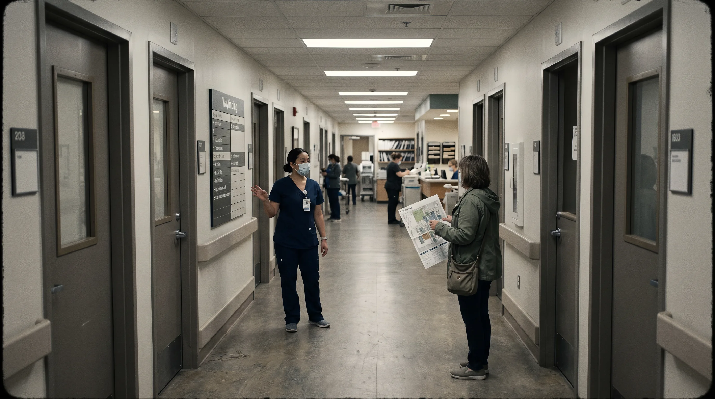
The three layers are worth separating because each carries its own cost and vendor choice. The positioning layer is hardware and signals: beacons, access points, UWB anchors, or camera-based tracking. The routing engine is software that turns a floor plan into a navigable graph and computes shortest or step-free paths. The interface is the mobile app, web app, or kiosk the visitor actually touches.
Indoor navigation is not the same thing as a real-time location system (RTLS). An RTLS tracks assets like wheelchairs, infusion pumps, or forklifts for staff dashboards. Indoor navigation guides people. The two often share positioning infrastructure, which is why a single beacon network can power both, but the deliverables differ. Knowing which you need keeps scope honest from the first conversation.
Which Industries Need Indoor Navigation Most?
Hospitals, airports, warehouses, retail malls, and large corporate campuses see the strongest return on indoor navigation because each loses measurable money or time to poor wayfinding. Hospitals burn staff hours and miss appointments. Airports leave retail revenue on the table. Campuses waste productive time. The business case differs by venue, so the right technology and budget differ too. Demand is climbing across all of them: the indoor positioning and navigation market, valued at $4.31 billion in 2024, is projected to reach $32.31 billion by 2033, per Business Research Insights data reported by PenguinIN.
Hospitals and Healthcare Campuses
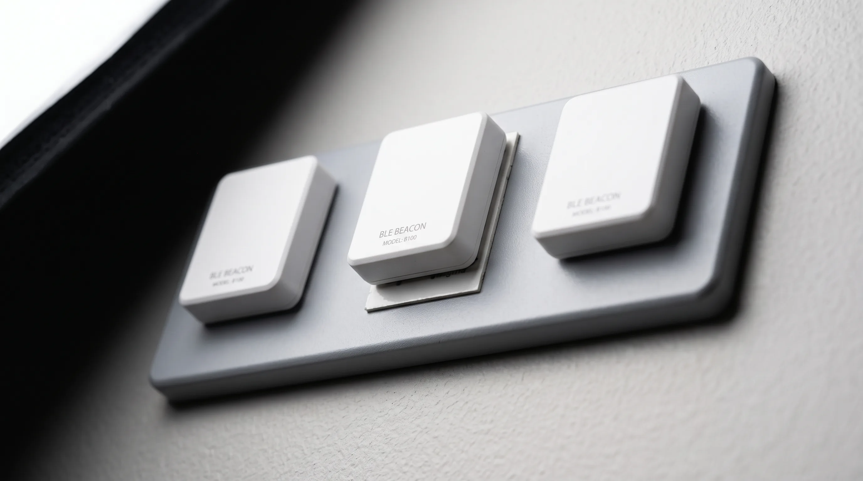
Hospitals need indoor navigation because wayfinding failures cost them staff time, missed appointments, and staff safety. A survey of 301 US hospital staff reported by Mapsted, drawn from the HERD (Health Environments Research & Design) Journal in 2025, found each staff member spends around 30 minutes a week helping people find their way. A 2,000-person hospital loses the equivalent of roughly 25 full-time roles to that alone.
The numbers scale alarmingly. US hospital staff collectively lose an estimated 98 million nurse hours a year to wayfinding assistance, equal to 51,072 full-time nursing positions, per SAGE Journals data cited by Zappar in 2025. The same source reports that University Hospitals of Leicester cut wayfinding-related Did Not Attend rates by 19% during an August 2024 to March 2025 pilot, freeing more than 40 staff hours a week.
It is also a safety issue. Nearly 44% of hospital staff reported abuse from frustrated visitors tied to wayfinding problems, per the HERD survey. Reliable navigation is staff protection, not just patient convenience.
Airports and Transit Hubs
Airports need indoor navigation because better routing directly lifts retail revenue and smooths passenger flow through a constantly changing layout. Airports that deployed augmented reality wayfinding report 2% to 3% increases in non-aeronautical revenue from duty-free, food and beverage, and lounges, according to Volpis in 2026. For a large terminal, a few percentage points of concession spend is a serious number.
Real deployments are already live. Incheon International Airport uses AR directional overlays in its app, Gatwick Airport combined Bluetooth beacons with AR overlays, and Changi Airport runs camera-based routing with multilingual AR cues. Airports favor these approaches because gates change and security lines shift. A system that reroutes dynamically beats a static beacon map when the floor plan effectively rewrites itself hour to hour.
Warehouses, Corporate Campuses, and Retail
Warehouses, campuses, and malls need indoor navigation because it recovers productive time and guides people across sites too large to sign adequately. Office buildings using indoor navigation report 10% to 20% increases in effective working time on average, according to Navigine in 2025. Warehouses add guided picking routes and geofencing alerts to cut misplacements.
Retail malls use anchor-to-anchor routing, sending a shopper from the entrance to a major retailer and then to a secondary destination, which outperforms generic “nearest shop” search for conversion. Large corporate campuses deploy a wayfinding app so visitors and new hires cross multi-building sites without signage overload. At campus scale, many operators pair navigation with a digital twin for real-time facility management, turning the map into a live operational model.
BLE, WiFi, UWB, and AR Wayfinding: A Buyer’s Technology Comparison
The four main indoor positioning technologies differ most on four things a buyer actually feels: install cost, accuracy, ongoing maintenance, and device compatibility. BLE is cheap and broadly compatible but coarse. WiFi reuses existing hardware. UWB is precise but expensive and device-limited. AR wayfinding skips beacons entirely. The table below sets the baseline, and the sections after it explain the trade-offs.
| Technology | Accuracy | Hardware cost | Maintenance | Device support |
|---|---|---|---|---|
| BLE beacons | 1–3 m | $10–$25 per beacon | Replace every 3–4 yr | iOS + Android (broad) |
| WiFi fingerprinting | 5–15 m | $100–$300 per AP | Resurvey on layout change | iOS + Android |
| WiFi RTT (802.11mc) | < 1 m | Uses existing APs | Firmware updates | Android only (~30% of users) |
| UWB | 10–30 cm | $200–$500 per anchor | Low, hardware-intensive | Premium devices only |
| AR visual-anchor (SLAM/VPS) | ~1 m | No beacons required | Map updates on layout change | iOS (ARKit) + Android (ARCore) |
BLE Beacons
BLE beacons are battery-powered transmitters that deliver 1 to 3 meter accuracy at $10 to $25 per unit, which makes them the default for budget-conscious, fast deployments. They mount with adhesive, need no wiring, and install in under two minutes each. Paired with a phone’s inertial sensors, BLE handles room-level and corridor guidance well.
The catch is maintenance. A large venue running 200 to 800 beacons replaces them every 3 to 4 years as batteries die, per Ariadne in 2026. Bluetooth 6.0 Channel Sounding promises about 1 meter precision through phase-based ranging, but CrowdConnected notes it is not yet viable for indoor mobile positioning at scale in 2026 because of line-of-sight and battery constraints. BLE wins when budget is tight and sub-2-meter accuracy is enough.
WiFi Positioning
WiFi positioning reuses the access points a building already has, which makes it the cheapest starting point when floor-level guidance is sufficient. It comes in two modes. Fingerprinting surveys the space and maps signal patterns for 5 to 15 meter accuracy, but requires resurveying whenever the layout changes. WiFi RTT (802.11mc) measures time-of-flight for sub-1-meter accuracy, but runs on Android only, which CrowdConnected puts at roughly 30% of a typical venue audience.
A newer standard, WiFi 802.11az, is in development and shifts positioning to the access points themselves using precise time-of-flight. WiFi wins where the network already exists and zone-level accuracy clears the bar.
UWB (Ultra-Wideband)
Ultra-wideband delivers 10 to 30 centimeter accuracy, the best of any mainstream option, but its cost and device limits confine it to specialized use. Anchors run $200 to $500 each at high deployment density, and tags add $30 to $100 per device, according to Volpis. It needs premium handsets most visitors do not carry.
That profile points UWB at asset tracking and automation rather than visitor wayfinding. Infusion pumps, forklifts, and robots benefit from centimeter precision; a patient’s phone cannot read it. The UWB market is growing above 20% a year, per Zapt, yet handset support keeps it niche for public navigation. UWB wins for high-value asset tracking, not general wayfinding.
AR Visual-Anchor Wayfinding (SLAM and VPS)
AR visual-anchor wayfinding uses the phone camera to place directional arrows into the live view, removing beacon hardware entirely. ARKit on iOS and ARCore on Android handle the rendering. The positioning underneath comes in two flavors, and the distinction matters. SLAM builds a map as the device moves, so, as MultiSet AI puts it, “the coordinate frame starts wherever the device started, so two devices do not agree with each other.”
A Visual Positioning System (VPS) fixes that by localizing against a pre-built 3D map, from an E57 point cloud, a Matterport scan, a Gaussian splat, or a phone LiDAR capture, which enables persistent content and centimeter accuracy in mapped zones. The cost is battery: continuous AR sessions drain 10% to 20% an hour, per Ariadne. Building these overlays well is specialized iOS and Android work. AR wins where visitor experience is the differentiator and beacon maintenance is unwelcome.
Here is the selection rule most vendor guides skip: choose your technology by visitor device mix before you look at accuracy specs. UWB and WiFi RTT both top the accuracy chart, and both are useless to a general-public audience whose phones cannot read them. For a hospital lobby or airport concourse, device compatibility is the first filter and accuracy is the second. For a staff-only warehouse where the company hands out the hardware, that order flips and UWB becomes viable.
Need help building indoor navigation for your venue?
We are here to help!
Off-the-Shelf Platform, Custom App, or AR Overlay: Which Build Approach Is Right?
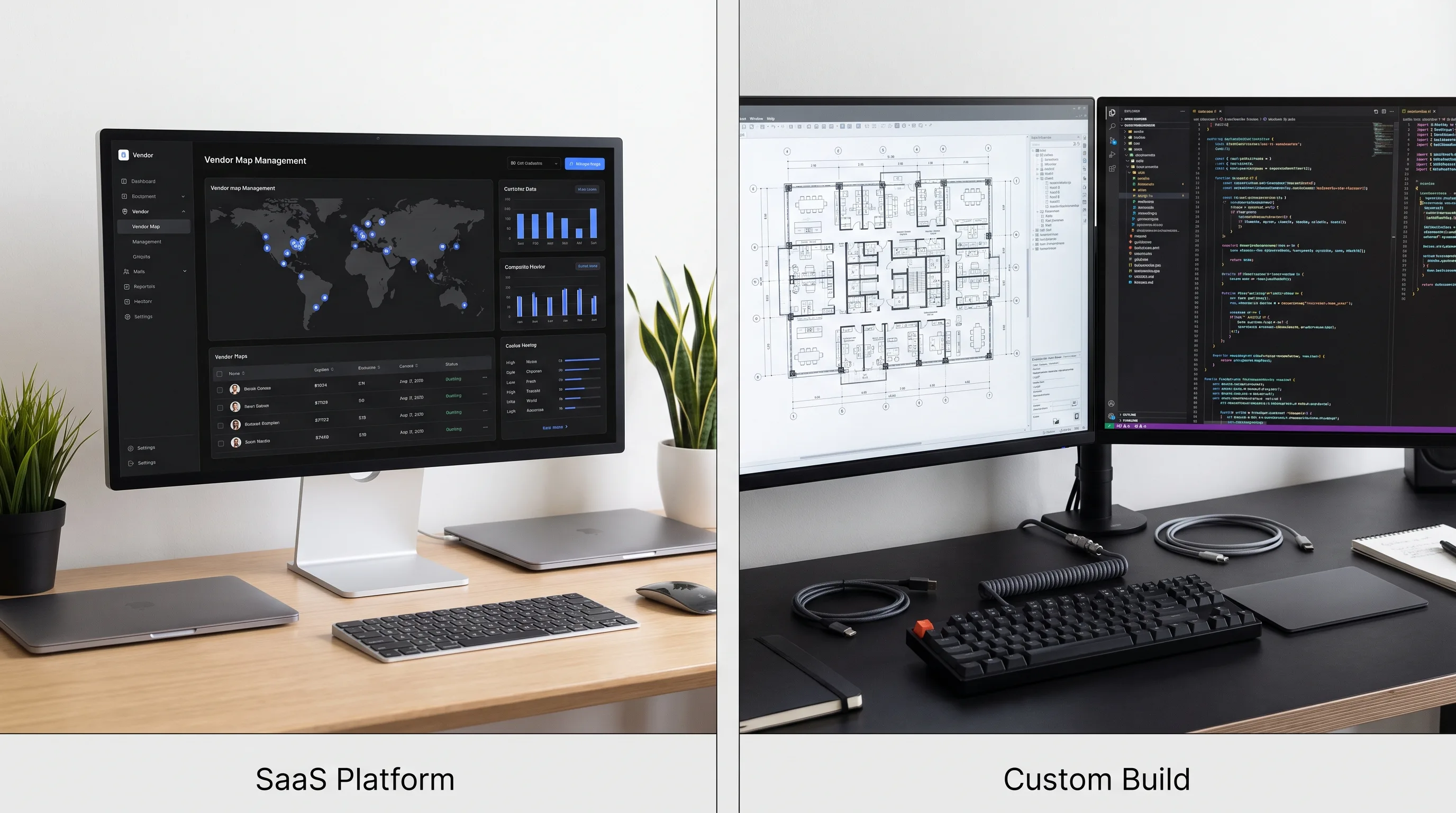
There are three ways to build an indoor navigation solution: license an off-the-shelf platform, build a custom app, or build an AR-anchor overlay. The right choice depends on how much you need to differentiate the experience, how tightly it must integrate with your existing systems, and how you feel about recurring license fees. Cost matters, but integration depth usually decides it.
Off-the-Shelf SaaS Platform
An off-the-shelf SaaS platform is the fastest path to a working deployment, trading customization for speed. Platforms like Mappedin, Navigine, Situm, and IndoorAtlas bundle map management, routing engines, and white-label apps, with pricing that can start around $165 per map per month. You get a proof of concept quickly.
The trade-offs show up later: limited UI customization, vendor lock-in on your floor-plan data, and restricted API access when you need to integrate an EHR, a flight-management feed, or a building-management system. SaaS fits organizations with simple floor plans that need a result soon and do not need deep backend ties. When requirements outgrow the platform, teams migrate to a custom mobile app build. Off-the-shelf wins for proofs of concept and standalone wayfinding.
Custom Native Indoor Navigation App
A custom native app is the right approach when wayfinding must behave as part of a larger product, not a bolt-on beside it. Built natively in Swift or Kotlin, or cross-platform, it integrates directly with an EHR in a hospital, flight information displays in an airport, or a WMS in a warehouse. It also lets you swap the positioning vendor without rebuilding the interface.
This reframes the build-versus-buy question entirely. Build-versus-buy is not really a budget decision; it is a product-integration decision. If the navigation layer has to live inside your clinical or operations software, off-the-shelf SaaS is ruled out at any price, because its API simply will not reach where you need it to. Custom development starts near $60,000 for a single-venue MVP and scales with integration depth. App friction is real: 46% of installs are uninstalled within 30 days, per AppsFlyer data cited by Zappar in 2025. A custom build lets you design around that with a dedicated AR development team or a full AR app build. Custom wins when integration and control are non-negotiable.
AR-Anchor Wayfinding Overlay
An AR-anchor wayfinding overlay replaces the 2D map with arrows drawn onto the real corridor, which closes the comprehension gap in stressful, unfamiliar spaces. There is no beacon hardware to install; mapping comes from existing BIM or CAD files or a phone LiDAR capture. In a hospital admissions area or a packed terminal, an arrow on the floor ahead is easier to follow than a dot on a map.
Frame Sixty, an AR/VR and spatial computing development studio, builds AR wayfinding apps on ARKit and ARCore for enterprise venues. The approach needs a custom build and a positioning backend, so it sits above SaaS on effort. It also avoids the beacon-replacement treadmill.
Over a five-year horizon, this changes the math in a way upfront quotes hide. A BLE network of 200 to 800 beacons gets replaced every 3 to 4 years, so a venue effectively buys its hardware roughly one and a half times inside five years, plus the labor to swap each unit. AR-anchor wayfinding carries no such cycle; its recurring cost is map updates when the layout changes, which is software, not hardware. For a large venue committed for the long term, AR can undercut beacons on total cost of ownership even when its first-year build costs more. AR-anchor wins where experience quality and long-run cost both matter.
Large Campus Deployments: Pairing Indoor Navigation with a Digital Twin
Large campuses benefit most from building indoor navigation on top of a digital twin, giving operations one data model for routing and asset awareness at once. The digital twin holds the floor-plan graph, live equipment positions, and capacity data; the navigation app queries it at runtime, so routes adapt as conditions change. A corridor closed for cleaning or a ward at capacity updates the route automatically.
This is the architecture behind $150,000 to $300,000+ deployments where wayfinding is one service inside a broader facility-intelligence platform. It also extends naturally to spatial computing hardware for staff-facing operations views. Digital-twin pairing wins for multi-building operators who need navigation and real-time asset data together.
How Much Does an Indoor Navigation Solution Cost — and How Long Does Deployment Take?
An indoor navigation solution costs from about $20,000 for a basic single-floor pilot to $300,000 or more for a full enterprise deployment, with timelines from a few weeks to 12 months. The two biggest variables are infrastructure hardware density and the depth of backend integration. Accuracy requirements and venue size move the number, but integration is usually what stretches both budget and schedule.
Cost by Deployment Scope
Cost tracks scope closely, so it helps to band it. A basic single-floor system with existing WiFi starts from $20,000 and can deploy in weeks, according to Volpis. The bands look like this:
- Single-floor BLE pilot, existing WiFi, no custom backend: from ~$20,000; deployable in weeks.
- Multi-floor custom iOS or Android app, BLE plus native build, no backend integration: $60,000–$150,000; 3–4 months for an MVP.
- Full-campus enterprise, custom app plus BLE or AR with EHR or BMS integration: $150,000–$300,000+; 6–12 months.
- Airport AR terminal, ARKit/ARCore with BLE or WiFi RTT and retail integration: $60,000–$150,000 per terminal, per Volpis.
Budget for upkeep too. Hardware maintenance runs 10% to 20% of the initial install a year, and beacon-based venues face that 3-to-4-year replacement cycle. For broader context on app economics, see Frame Sixty’s guide to mobile app development cost.
What Drives the Final Number
Five levers drive the final cost, and a buyer controls most of them. Understanding them turns a vague quote into a scoped estimate.
- Floor-plan quality. Current BIM or CAD files save mapping time; outdated drawings force a Matterport or phone LiDAR recapture.
- Infrastructure density. BLE accuracy improves with more beacons, and UWB cost climbs steeply with anchor count.
- Platform license versus custom build. SaaS shifts spend from capital to recurring operating cost.
- Backend integration depth. Wiring into an EHR, a flight-management system, or a BMS multiplies development time more than any other factor.
- App delivery model. A native download adds QA cost and the 46% uninstall risk; a web or QR entry point reduces friction but limits AR features.
That last lever deserves a sharper recommendation than most guides give. Split your delivery model by audience. One-time visitors should reach the system through a QR code or web app, sidestepping the uninstall problem entirely, since nobody downloads an app for a single hospital visit. Repeat users, mostly staff, get the native app, where background positioning and AR features actually pay off. Designing two front doors for two audiences is cheaper than forcing everyone through one. Emerging platforms shift these costs again, which Frame Sixty’s Android XR development guide covers for teams planning ahead.
Deployment Timeline by Approach
Timeline tracks approach and integration depth, ranging from a couple of weeks to a year. The quick reference:
| Approach | Timeline |
|---|---|
| WiFi fingerprinting (existing infra) | 2–4 weeks |
| BLE beacon pilot (single floor) | 4–8 weeks |
| AR navigation MVP (single building) | 3–4 months |
| Custom native app + BLE (multi-floor) | 4–6 months |
| Full enterprise + backend integration | 6–12 months |
The 3-to-4-month AR MVP assumes floor plans and anchor zones already exist at project start, per Volpis. When they do not, mapping adds weeks. Across every row, backend integration into an EHR, a flight system, or a BMS adds the most time, regardless of which positioning technology you pick.
In our AR app work at Frame Sixty, floor-plan ingestion is the first technical gate on any wayfinding project, and it decides the early schedule more than the positioning choice does. When a venue has clean BIM or CAD files, the floor-plan graph comes together fast. When the drawings are years out of date, which is common in older hospitals and terminals, we fall back to a phone-LiDAR or Matterport capture and reconcile it against what is physically there. Doors move, walls get added, and the map has to match the corridor a person is standing in, not the one an architect drew a decade ago.
We also design AR wayfinding around the battery reality rather than against it. Because continuous AR sessions drain a phone fast, we treat the camera overlay as a decision-point tool, not a constant display: the app shows AR arrows at turns and junctions, then hands back to a lightweight 2D map on long straight stretches. That pattern keeps the experience legible, protects the battery across a full airport transit or hospital visit, and reflects a general tradeoff judgment any studio building on ARKit and ARCore has to make. The alternative, holding a live camera feed for twenty minutes, drains the device and the user’s patience.
Get a Scoped Estimate for Your Building
Getting a scoped estimate for an indoor navigation solution means having a partner review your floor plans, recommend a technology based on your visitor device mix and accuracy needs, and return cost and timeline bands for a pilot floor versus a full rollout. Every building is different. A 20-minute call that ends with a real cost range is not a sales pitch; it is the number you need for your budget conversation.
The right partner starts with three questions. What do your floor plans look like, and how current are they? Who walks through your doors, and what phones do they carry? And what does the navigation system need to talk to, an EHR, a flight feed, a WMS, or nothing at all? Those answers decide the technology, the architecture, and the price far more than any brochure spec.
That ordering is the whole argument of this guide. Accuracy you cannot deliver to your visitors’ phones is wasted money, and a positioning layer that cannot reach your backend produces confident, wrong directions. Get device compatibility and integration right first, and the rest follows.
Conclusion
An indoor navigation solution is worth building when wayfinding failures cost you real money, and for hospitals, airports, and large campuses, the evidence says they do: 98 million lost nurse hours a year in US hospitals alone, per SAGE Journals data reported by Zappar in 2025, and millions in forfeited airport retail spend. The technology is mature. BLE covers budget deployments, WiFi reuses existing hardware, UWB serves asset tracking, and AR-anchor wayfinding delivers the strongest visitor experience without a beacon-replacement cycle.
The decision that matters is not which technology has the best accuracy spec. It is matching the approach to who uses your building and what your systems require. A public venue should lead with device compatibility and backend integration, not centimeter precision it cannot deliver. A staff-only facility can chase precision because it controls the hardware. Scope the solution to the real audience and the real integration, and it will pay back; scope it to a spec sheet, and it will not.
If you are evaluating indoor navigation for your venue, get in touch with Frame Sixty for a scoped estimate built around your floor plans, your visitors, and your systems.
FAQs
Common questions about how indoor navigation solutions work, what they cost, and how to get one built for your venue. Each answer stands on its own.